It’s often the ‘high’ point of a visit to Donegal – literally, but moves are now afoot to make sure Ireland’s most iconic mountain doesn’t drop a few inches because of its popularity.
Donegal County Council is currently working with a steering group committee to consider and investigate options to address the ongoing erosion of the existing access to the mountain due to the increased number of the visitors climbing there over the last 20 years.
The 751-metre (2,464 ft) mountain near Gweedore is the tallest peak of the Derryveagh Mountains, the tallest peak in County Donegal and the 76th tallest peak in Ireland.
The mountain is well known for the pinkish glow of its quartzite in the setting sun. Another noted quality is the ever-changing shape of the mountain depending on what direction you view it from. Errigal was voted 'Ireland's Most Iconic Mountain' by Walking & Hiking Ireland in 2009.
On a clear day the views towards Muckish, Tory Island, Bloody Foreland, Slieve Snacht are said to be amongst the best in Ireland.
Donegal County Council and Dunlewey Development Committee have appointed a consultant to assess the ongoing problems with the access path to Errigal Mountain with a view to make recommendation on addressing the problems.
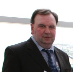
Charles Sweeney works in the Community, Development & Enterprise Division of the Council and is closely involved in this project and he tells us more about this work.
“Donegal County Council and other stakeholders including representatives from Mountaineering Ireland, National Parks and Wildlife Service as well as locals from Dunlewey are currently examining a number of options.
“The construction of a car park for visitors along the R251 in the mid-eighties has focused the majority of walkers into one access point and encouraged increased usage as a starting point, with consequent negative environmental impact on this aspect of the mountain.
“The route initially starts off by crossing heavily eroded and boggy land towards a visible track through the shiny scree from where the ascent proper starts. After reaching the summit, people usually walk the short but exposed walk along ‘One Man’s Pass’ which leads across to the second and lower of the twin summits. No special equipment is needed to climb the mountain, but caution is advised,” said Charles
He added that the overall objective of the Errigal Mountain Steering Group is to cater for the growing number of visitors to this wonderful natural resource, while minimising the environmental impact and creating opportunities for the local communities.
“The group has recently commissioned a study which aims to assess the condition of the path network and prioritise path sections where management is required” he said.
Work on the future of Errigal is taking shape and considering where it is, it’s only right that such an asset is cared for. Errigal is the most southern, steepest and highest of the mountain chain, called the ‘Seven Sisters’ by locals. The ‘Seven Sisters’ includes Muckish, Crocknalaragagh, Aghla Beg, Ardloughnabrackbaddy, Aghla More, Mackoght and Errigal. The nearest peak is Mackoght, which is also known as Little Errigal, Wee Errigal or An Earagail Bheag.
Donegal’s mountains are an asset too.
Key Facts
Mr Chris York from Walking the Talk is currently in the area undertaking surveys and consultations. He met locals and interested parties in the Dunlewey Community Centre last Saturday to discuss their views on the access to Errigal Mountain.
Do you have photos of Errigal from four or five years ago? If yes please share on Donegal County Councils Facebook page so you can help find out how best to address erosion on Errigal.
You can also e-mail your submission to [email protected] by August 5.
ENDS
Select an option below